Mt Shasta is so
dominating that at 50 miles, crossing the Oregon – California border on US-97,
it is the most dominating thing in the horizon.
The dominating peak at 14,179 feet (4,322 meters) is almost as high as
Mt Rainier (Mt Rainier is 249 ft higher).
In addition to the main summit the prominent satellite cone of Shastina
is 12,330 ft (3,760 m). It
looks so big because it is self standing – it has no other peaks nearby; it
rises abruptly above the surrounding terrain.
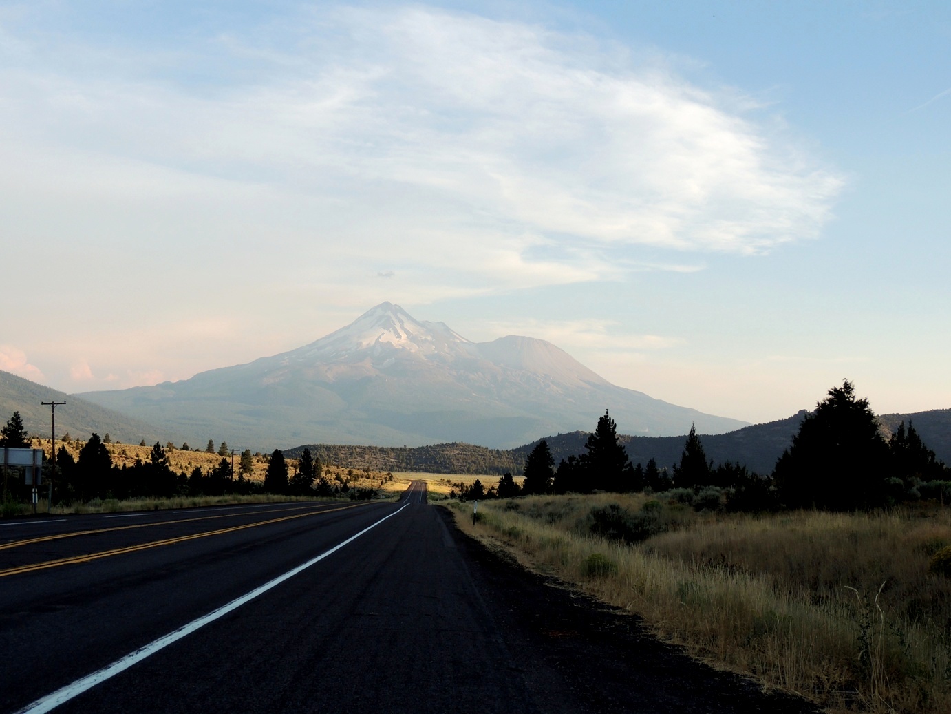
Mt Shasta from just across the Oregon Border
I wanted to hike the
south side on “Sergeants Ridge,” the U-shaped Avalanche Gulch - the largest
glacial valley on the volcano. However, we
were behind on our travel schedule and had to be several hundred miles away on
Manchester Beach by the evening and still had some tough mountain roads and the coastal road to drive and only had a few hours of hiking time. We made out way to the trail head at about
7000 feet and hiked the gulch, just above the tree line for a couple of hours
and began to make our way back down. It
was a good thing because the air was too thin for serious hiking and we had run
out of sun block and probably would have ended up with some serious sunburn had
we stayed there all day.

Avalanche Gulch at about 7800 ft


By the way, if you ever wondered where all the Hippie culture from the 1960s went, wonder no more, they went to the town of Mt Shasta, CA. right at the bottom of the volcano. The colors, the dress, the VW buses and bugs painted in wild colors and the smell of weed everywhere - I loved it, it took me back to the 1960s. Although there were many "older" hippies (my age), I was surprise to see so many young people following the cultural tradition.
The road
from Redding to Eureka on state road 299
had to be the most white-knuckled, butt tightening, muscle tensing, frightening
drive I have been in a long time. 160
miles of winding mountain road with only a railing to keep you from dropping
1000 feet to your death (oh wait, there was no railing!) The speed limit was 55 but all the northern California
rednecks – who seem to have trouble reading speed limits, thought it was
70. The road went from 5000 to 3000 feet
in only several miles and then back up to 5000 feet. Not only was the road and the rednecks with
their giant Dodge Ram pickups a challenge, the most scary part were the lumber
trucks most of them with tandem trailers full of logs barreling in both
directions thinking they had total control of their brakes. Now, why would lumber trucks travel both east
and west? You would think that lumbering
in the west would sell to West side mils and lumbering in the east of the
mountains would sell to east side mills. But
Noooooo…. They had to do it the hard
way.
From Eureka
I took US 101 to Leggett, CA and then caught the CA 1, the coastal road. I wanted to drive down the coast in the late
afternoon and see the sunset on the coast, but because we got a late start from
Mt Shasta, we only got to see the end of the sunset as we got to the coast and
then the whole coast was quickly covered in fog. 140 miles of narrow coastal road, in the dark
with not even a rail to prevent you from driving over the cliff into the
Pacific Ocean, was not very much fun.
But it kept me alert and did not even get motion sick. We finally got to Manchester Beach, our
destination for the evening, by 9:50 p.m. and was so tired that we didn’t even
had dinner before we went to bed.
The next day
we drove the rest of the coastal road to San Francisco and got to enjoy the
scenery, although there was still plenty of low fog on the coast.
No comments:
Post a Comment