Hiking up Mt. Baker
Mt. Baker
is a volcano with a peak of 10781 feet (3286 meters). Although we could not hike to the top since
we do not have the equipment or the permission and even if we had, we were in
no physical shape to hike at the altitude on a glacier. My plan, however, was to drive to the little town of Glacier,
Washington about 10 miles from the Canadian border on the north side of the
North Cascades National Park and hike from Mt Baker Vista point (about 4500
feet) to the edge of the Roosevelt Glacier, on the western side of Mt Baker at
about 6500 feet. At the time of the day
(we would have reached it at about 4:00 p.m.) we would have had some fantastic
pictures of the mountain. But
noooooo…. It turns out that the service
road up Glacier Creek was washed out and not open.
Given the
time of day, I decided that we could hike up the Ptarmigan Ridge on the East
side of the mountain and still have some good shots of the mountain top. But after looking at the ridge, about a mile long, and what seemed to be a mountain slide waiting to happen, there was
no way that Adrian and I were going to be caught up in that. So instead, I decided to take a hike up
toward Mount Shuksan, a peak about 10 miles east of baker at 8131 feet. We could still get to n edge of a glacier at
about 6800 feet and at least the waste a day of hiking. It was a great and easy hike.


Along the hike to Mt Shuksan

Ridge trail to Mt Baker

Zoom in on hiker on Ridge Trail
The
following day I decided to circle around the mountain (a trip of almost 2
hours) and approach Mt Baker from the southern side. We got
up late and drove to a little town named Acme, WA. The population of the town must have been
under 100, but it had the ACME DINER, the best breakfast we have had in a long
time. The entrance to the southern part
of the park is not marked very well and unless one knows what to look for, it
cannot be found. We finally stopped at a
farmers coop gas station, around where the entrance should be and asked the
clerk working, an older lady, and she said “well yes, its right across the road
just take that road there north and you can’t miss it.” A National Park with no marking from the main
road!? About 20 miles later, with 10 of
those miles of unpaved forest service roads, we got to our destination , about
5 miles (“as the crow flies”) below the bottom point of Easton Glacier. We were at 3400 feet and had to hike to about
6000 feet – yeah right!
We got
started about 1:00 p.m. and about a mile
into the hike (before we started up any serious elevation) we had to portage
across Sulphur Creek. This is glacial
melt with a water temperature of what seemed to be 32.0001 degrees – COLD! But we took our shoes off, and crossed
it. There were several other people that
were crossing back some of them stating that it was a very strenuous
climb. But we weren’t about to turn
back. The portage was rough because of
the sharp stones and the fact that we did not bring sandals to walk on the
rocks.


On the edge of one of the Glaciers

Skiers coming back from Baker Glaciers
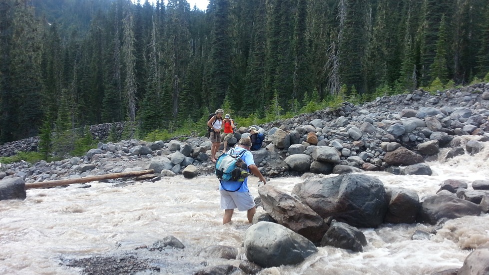
Crossing a cold stream on the hike up (met a couple of hikers coming down)

On the way to Mt Baker
The climb
was tough, going up a couple of thousand feet in about half mile. On the way up there we met some hikers with
skies coming back down; they had hiked up early in the morning to take in some
skiing on the glacier. These are the times that being a crow would
have come in handy and simply go from point to point “as the crow flies.” We finally go to a meadow at about 5500 feet
and we still had about 3 miles to go to the edge of the glacier. However, it was 5:00 p.m. and we had to start
back if we wanted to get to the place we started before it got dark.


View from about 6100 feet

Mt. Baker From edge of Glacier

Crossing the stream on way back down
Of
course, the hike back was a lot easier and faster and made it back to the ice
cold Sulphur Creek by 6:00 p.m. and because of higher melting rates during the
warm day, the creek had a higher flow.
But we made it across.
We made
it back to the car and to the town of Burlington, WA were we had dinner. We decided to stay at Burlington for the
evening mainly because we were too tired to drive back. The following day we were on our way to Mt
Rainier – a peak 4000 feet higher than Mt Baker.
Mt. Rainier Hike
We could
see Mt. Rainier from down the street where Rebeca and Rob live. At a distance of over eighty miles it was a
tall peak piercing through the clouds.
Unfortunately we had to drive through Seattle and all the suburbs to the
north and south. It was the biggest
traffic mess I have been in a long time.
It took us almost two hours to go a little over 40 miles to the town of
Auburn where we would take the road to Mt. Rainier. The mountain was in sight throughout the trip
getting bigger and bigger as we got closer.
Once we got past the town of Enumclaw, we entered the forest area and
the mountain was difficult to see through the high pine trees.
Our
destination was a National Park campground, Ohanapecosh, at about the 2000 foot
level. Probably the most beautiful
campground in the country with the old growth pine forest towering over 200 feet in the air and a
crystal clear mountain river flowing through the center with pools of water
that one can dive from the 20+ foot boulders lining its sides.


Making breakfast before hike

Our Campsite at Ohanapecosh
This
would be our base camp for the next three days from where we would hike some of
the tails at the lower altitudes and hike to the edge of a couple of the Glaciers. The first trip was a casual stroll around
Sunrise on the eastern part of the Volcano about 5800 feet. The trail we took only had a rise of about
1000 feet, but it proved to be tiring.
The total hike was less than three miles.
The
second day of hiking included three hour hike from Paradise point on the
southern side of the volcano, a short
second hike to see some waterfalls an mountain streams. The map below shows the path we took. It is the same path that people hiking up to the very top take. They get to Camp Muir about 10,000 feet (about three miles from our highest point) they rest of the night and make it up the top after hiking about 12 hours on ice.
We later came and bathed in the coldest river anyone can imagine. The water could not have been much above freezing, and I swear that it was only 32.00001 degrees F – well, at least it seemed that cold.
We later came and bathed in the coldest river anyone can imagine. The water could not have been much above freezing, and I swear that it was only 32.00001 degrees F – well, at least it seemed that cold.

Path of Climb to
the edge of Paradise Glacier

At about 6300 feet

Mt Adams - Far peak at the Center of Picture

There was some minor climbing

Nisqually and Wilson Glaciers view from 6300 ft

Nisqually Glacier and zoom in on waterfall in center (below)

The Nisqually Glacier has receded about 2000 to 3000 feet. About 27 years ago, I took Rebeca, Adan and a nephew, Steve, hiking in the ice caves of the Nisqually Glacier in what it is now the valley below. It is now just a rocky valley.

The Ohanapecosh River

Going for a swim (and a bath since there are no showers in the camp)

Our next trip is camping on the Pacific Beach in the Western part of the State of Washington and a trip to the Olympic mountain range (Olympic National Park and hike up Mt Olympus.
No comments:
Post a Comment