Monday, August 26, 2013

San Francisco and the Bay Area- the last of the Vacation


The word China is derived from Ch'in, the first dynasty to unify the country by conquering the warring feudal states and took the title first august emperor in 221.  During short his reign over China, the Ch’in Dynasty also introduced several reforms: currency, weights and measures were standardized, and a better system of writing was established. He also did some terrible things; an attempt to purge all traces of the old dynasties led to the infamous burning of books and burying of scholars incident.  Two of the key things that he did was to standardize the Chinese language by having all writing be the same; south and north china may sound different but they can communicate in the same writing.  The second thing that he did was to standardize the length of the wagons wheel base.  Chinese roads were grooved to different size axels and one wagon could not go into a different region because of the different wheel base.  Simple things like that is what made modern china possible.  (Although my major in college was engineering my minor was in Chinese history.)

But when it comes to standardization, Emperor Ch’in had nothing over the U.S.  We have Fast food everywhere (McDonalds, Burger King, Wendy’s, etc) and we also have standard shopping centers with Kohl's, Target, WalMart,; standard gas stations, standard roads and road signs, standard dress and modes of behavior (except for 
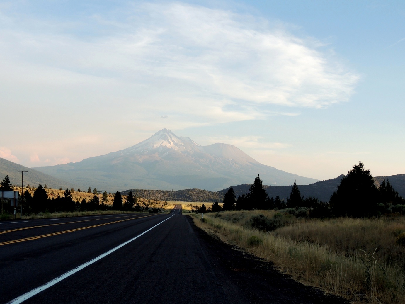
Mt Shasta, CA where the 1960 Berkley hippies retired) and standard evolution of our language.  One of my frustrations is that no one responds “You’re welcome” to the expression “Thank you.”  Everywhere you go in the country the new standard response to “Thank You,” from everyone one under 40, is “No Problem.”  To me that is not an expression acknowledging the fact that the person saying “thank you” is grateful for your kindness.  It is more of an expression of “Yeah, I know I did something good for somebody, I did not mean to, and it was no problem to me to take some casual effort from my busy life to casually help out a destitute.”  I feel like I’m being left behind in this language evolution, but nonetheless, I will continue to use the response “You’re welcome” when someone says thank you.

OK, back to the travel summary:  we spent our last week as standard tourists in San Francisco and the Bay area, reliving my years at Stanford University and  taking side trips to Monterrey and Carmel, Muir Woods and the beaches south of San Francisco.  It was almost like being home again.  I got to visit my old office in the southwest corner of the Stanford Quad, bought a few T-shirts at the book store and showed Adrian where he might go to school if he got all “A” and aced his college exams – in one ear and out the other.

I took advantage of the San Francisco, Monterey and Sausalito Wharfs to consume my favorite food – Dungeness Crab.  Took the standard tourist trip around Carmel with the 17-mile drive; a chance to see how the other side lives.  I got the feeling that just looking at the players on Pebble Beach golf course was a violation of their wealth domain.  But the scenery was nice, although it would have been nicer if we did not have the constant low-hanging clouds (or high-hanging fog).  Even the Golden Gate Bridge could not be fully seen because of the fog, but we did see, only briefly, one the training runs for the boats competing for the America’s Cup – for a sailor like me, that was a real treat!  Sanford has not changed (maybe a couple of new buildings here and there) but it seemed like time has stood still and I was back in 1975.  Even the cumquat tree outside my window in the office I had as a graduate student and teaching assistant - where I made plans to jump out and climb if I ever felt an earthquake - was still there exactly as it was 35 years ago.  It was good to revisit the Bay area, the weather is perfect, and the people seemed more relaxed.  In a way I wished I had stayed here, but in 1979 I had Washington DC in my eye, and that is where I wanted to work.

San Francisco
 Riding on the Cable Car I felt like breaking out into
a song "Rice-a-Roni the San Francisco Treat."
Although a friend of mine said I should have started singing 
"Y.M.C.A."
 Riding the cable car our life depended on this guy to 
stop us from plowing into the crowd at the 
bottom of the hill.


Eating a dungeness Crab at the Wharf

 In Chinatown a must stop and eat site in SF


I could not tell what these were but they did not look tasty


Street Art

The San Fransisco Skyline in the fog


Monterey and Carmel

 One of the golf holes at Pebble Beach


 Sea Lions on the rocks off Pebble Beach

 Dungeness Crabs on the Monterey Wharf


Stanford and San Gregorio Beach

 My old office at Stanford (in the Basement)
The engineering corner of the Quad where I had my office
 Hoover Tower
 Entrance to Quad and Chapel


 San Gregorio Beach


Friday, August 23, 2013

Mt Shasta and the California Coast


Mt Shasta is so dominating that at 50 miles, crossing the Oregon – California border on US-97, it is the most dominating thing in the horizon.  The dominating peak at 14,179 feet (4,322 meters) is almost as high as Mt Rainier (Mt Rainier is 249 ft higher).  In addition to the main summit the prominent satellite cone of Shastina is 12,330 ft (3,760 m).  It looks so big because it is self standing – it has no other peaks nearby; it rises abruptly above the surrounding terrain.


Mt Shasta from just across the Oregon Border


I wanted to hike the south side on “Sergeants Ridge,” the U-shaped Avalanche Gulch - the largest glacial valley on the volcano.  However, we were behind on our travel schedule and had to be several hundred miles away on Manchester Beach by the evening and still had some tough mountain roads and the coastal road to drive and only had a few hours of hiking time.  We made out way to the trail head at about 7000 feet and hiked the gulch, just above the tree line for a couple of hours and began to make our way back down.  It was a good thing because the air was too thin for serious hiking and we had run out of sun block and probably would have ended up with some serious sunburn had we stayed there all day.

 Avalanche Gulch at about 7800 ft


By the way, if you ever wondered where all the Hippie culture from the 1960s went, wonder no more, they went to the town of Mt Shasta, CA.  right at the bottom of the volcano.  The colors, the dress, the VW buses and bugs painted in wild colors and the smell of weed everywhere - I loved it, it took me back to the 1960s.  Although there were many "older" hippies (my age), I was surprise to see so many young people following the cultural tradition.

The road from Redding  to Eureka on state road 299 had to be the most white-knuckled, butt tightening, muscle tensing, frightening drive I have been in a long time.  160 miles of winding mountain road with only a railing to keep you from dropping 1000 feet to your death (oh wait, there was no railing!)  The speed limit was 55 but all the northern California rednecks – who seem to have trouble reading speed limits, thought it was 70.  The road went from 5000 to 3000 feet in only several miles and then back up to 5000 feet.  Not only was the road and the rednecks with their giant Dodge Ram pickups a challenge, the most scary part were the lumber trucks most of them with tandem trailers full of logs barreling in both directions thinking they had total control of their brakes.  Now, why would lumber trucks travel both east and west?  You would think that lumbering in the west would sell to West side mils and lumbering in the east of the mountains would sell to east side mills.  But Noooooo….  They had to do it the hard way.

From Eureka I took US 101 to Leggett, CA and then caught the CA 1, the coastal road.  I wanted to drive down the coast in the late afternoon and see the sunset on the coast, but because we got a late start from Mt Shasta, we only got to see the end of the sunset as we got to the coast and then the whole coast was quickly covered in fog.  140 miles of narrow coastal road, in the dark with not even a rail to prevent you from driving over the cliff into the Pacific Ocean, was not very much fun.  But it kept me alert and did not even get motion sick.  We finally got to Manchester Beach, our destination for the evening, by 9:50 p.m. and was so tired that we didn’t even had dinner before we went to bed.

The next day we drove the rest of the coastal road to San Francisco and got to enjoy the scenery, although there was still plenty of low fog on the coast.


Tuesday, August 20, 2013

Crater Lake National Park


Try to imagine this scene 7,700 years ago:  A volcano similar in size to Mt St Helen, explodes blowing the top 1/3 of the mountain similar to what happened in St Helen scattering rock ash and dirt all over the countryside.  There had been people in North America for nearly 4000 years by then so I sure some of the native peoples bore witness to this cataclysmic event.  The sky got dark and it rained ash for days for hundreds of miles around the volcano.  This is what happened in Crater Lake!

However the parallels of the volcano at Crater Lake and Mt St Helen end there.  Where as in Mt St Helen the expanding magma underneath carried the lava to the surface and filled the cavity that the expanding gases had emptied, no so in the Crater Lake volcano.  The magma began to solidify deep underground and new vents continued to vent the camber below the exploding peak.  With nothing to support the rest of the mountain, it collapsed into itself sinking and leaving a crater in the shape of an inverted “peak” that that is over 3000 feet deep and over 6 miles wide.  Over the last 7000 years, rain and melting snow have filled the crater and it is now the deepest lake in the United States just shy of 2000 feet deep 1943 feet at its deepest point.

We had the chance to hike down into the crater, a round trip of about three three miles and a total ascent of almost 1000 feet.  It was a great walk down, but coming up was very difficult.  Although the ascent angle was not as steep as the ones we hiked in Mt Baker and Mt Rainier, the temperature was 85 degrees and there was little shade.  To complicate things, we usually take 3 or 4 bottles of water in our hikes but this time we only had half a bottle.  It was a hard one and one half miles at almost an 8 degree ascent.  But at the end it was worth it.  Adrian got to take a dip in the lake.


View of the hiking trail down to the lake